In the era of technological advancements, the concept of remote sensing simulation is reshaping the landscape of exploration and understanding. As we delve into the realms of virtual reality (VR) and augmented reality (AR), we uncover opportunities that allow us to navigate through complex environments without ever leaving our homes. Imagine a world where you can soar above mountains or traverse dense forests, all from the comfort of your living room. This isn’t just a fantasy; it’s a glimpse into the promising future of remote sensing simulation.
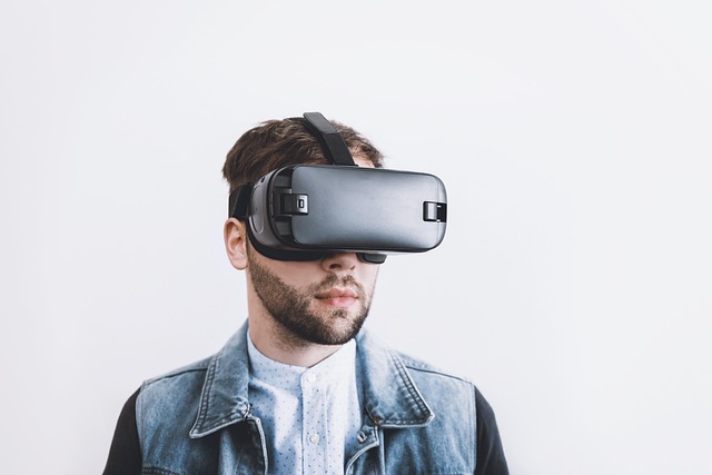
Virtual reality immerses us in computer-generated environments that mimic the real world. By utilizing VR headsets, users can engage with simulations that transport them to faraway places, allowing scientists and researchers to study ecosystems while minimizing their ecological footprint. With remote sensing simulation, data captured from satellite imagery and aerial observations is transformed into a virtual space, where interactive learning takes center stage. Users can analyze topographical changes, observe the effects of climate change, and understand geological formations in a more tangible way. This immersive experience supplements traditional education and research methodologies, thereby enhancing the understanding of complex subjects.
On the other hand, augmented reality complements our immediate environment by overlaying digital information onto the physical world. When applied to remote sensing simulation, AR can help visualize data layers of satellite imagery on existing landscapes. For example, with a mobile device, a user can point at a field and see climate data, land use changes, or even predictive analytics regarding crop yields right before their eyes. Such interactions bridge the gap between abstract data and relatable visuals, making the information accessible and actionable for farmers, urban planners, and conservationists alike.
The burgeoning concept of the metaverse adds another layer to this conversation. This collective virtual shared space embodies an amalgamation of augmented reality, virtual reality, and the internet. The metaverse is set to revolutionize remote sensing simulations by creating a persistent digital universe that can be explored collaboratively by users all over the world. Imagine scientists from different continents working together in a virtual lab, analyzing environmental data in real time, or educators leading immersive field trips where students can navigate through the data set interactively.
These technologies foster not only a deeper understanding of our world but also a sense of community and collaboration. The ability to share experiences and learn from one another enhances collective knowledge, which is essential in tackling the global challenges we face today. Whether it’s understanding biodiversity in a rainforest or tracking urban growth rates, remote sensing simulations powered by VR, AR, and the metaverse will grow increasingly critical in equipping us for the future.
As we continue to explore the boundaries of what’s possible with remote sensing simulation, we can confidently predict an evolution in how we engage with geographic and environmental data. Harnessing the power of virtual environments offers a profound shift in both education and research. The motivations behind these advancements are grounded not only in technological innovation but in a shared responsibility to understand and protect our planet.